Šavnik (Savnik)
Šavnik is a town in Montenegro and administrative center of the Šavnik Municipality. It is located at the confluence of three rivers - Bukovica, Bijela and Šavnik, at an altitude of 840 meters. It is the lowest lying settlement in the municipality.
Unlike most settlements in the area, which date back several centuries, Šavnik is relatively new, founded only in 1861. It was populated by migrants from other parts of Montenegro and Herzegovina, mostly craftsmen, merchants, riflers and blacksmiths, which were needed by local farmers. The area was overgrown with willows, which the newly formed town was named after (šavice – willow branches or seams, which were used as a roof covering).
Before the construction of first houses on the site of today's town, there were two mills on Šavnik River. The first three houses that were built in Šavnik were a tavern with a shop, rifle repair shop and a blacksmith shop. The town quickly became a center for the Drobnjaci region, and incorporated a post office, school, primary court, and military post.
Industrialization during the SFR Yugoslavia era mostly bypassed Šavnik, so did all major transit road or rail links, and economy of town went into stagnation. Population of Šavnik and entire municipality is since in slow but steady decline. Most of the residents are migrating to Nikšić and southern Montenegro, and Šavnik is often a synonym for a poor and deteriorating town. The new road Risan - Nikšić - Šavnik - Žabljak (P5), and proximity of Žabljak as a main mountain tourist resort in Montenegro may boost Šavnik's economic prospects.
Map - Šavnik (Savnik)
Map


Country - Bosnia_and_Herzegovina
 |
 |
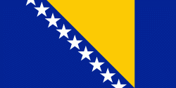
| Flag of Bosnia and Herzegovina | |
The area that is now Bosnia and Herzegovina has been inhabited by humans since at least the Upper Paleolithic, but evidence suggests that during the Neolithic age, permanent human settlements were established, including those that belonged to the Butmir, Kakanj, and Vučedol cultures. After the arrival of the first Indo-Europeans, the area was populated by several Illyrian and Celtic civilizations. Culturally, politically, and socially, the country has a rich and complex history. The ancestors of the South Slavic peoples that populate the area today arrived during the 6th through the 9th century. In the 12th century, the Banate of Bosnia was established; by the 14th century, this had evolved into the Kingdom of Bosnia. In the mid-15th century, it was annexed into the Ottoman Empire, under whose rule it remained until the late 19th century. The Ottomans brought Islam to the region, and altered much of the country's cultural and social outlook.
Currency / Language
| ISO | Currency | Symbol | Significant figures |
|---|---|---|---|
| BAM | Bosnia and Herzegovina convertible mark | KM or КМ | 2 |
| ISO | Language |
|---|---|
| BS | Bosnian language |
| HR | Croatian language |
| SR | Serbian language |